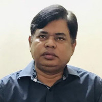
Director
Message from Director
Dr. M. Nazrul Islam is a distinguished scholar and a senior professor with a rich academic and professional background in physical geography, specializing in fluvial- geomorphological and environmental sciences. He currently serves as the Director of the Institute of Remote Sensing and GIS at Jahangirnagar University and carries nearly 35 years of experience in teaching, research,... Read More
About Institute of Remote Sensing and GIS
Contact Information
Phone: +8801730695998
Email: irsgis@juniv.edu
Academic Programs
- ২০২৩-২৪ শিক্ষাবর্ষের ইনস্টিটিউট অব রিমোট সেনসিং এন্ড জিআইএস-এর স্নাতকোত্তর (নিয়মিত) শ্রেণিতে ভর্তি পরীক্ষা সংক্রান্ত বিজ্ঞপ্তি
- Master of Science (MSc) in Remote Sensing and GIS for Session: 2022-23
- Master of Science (MSc) in Remote Sensing and GIS for Session: 2019-20
- 5th Certificate training course on Remote Sensing (RS), Geographic Information System (GIS), Global Navigation Satellite System (GNSS) and Drone Technology (3rd February -7th February 2018)
- Training program for Professionals on Remote Sensing (RS) and Geographic Information System (GIS) (30th November -15th December 2018)
- Click Here to View All
Research
- Click here to view our journal
- Wetlands of Bangladesh :Biodiversity, Livelihoods, and Conservation
- Impact of climatic parameters on spatiotemporal variation of air pollutants across Bangladesh
- State of the World's Rivers
- An Assessment of the Causes and Consequences of Landslides (2017) Occurred in the Southeastern Areas of Bangladesh
- Engaging Youth in Flood Risk Management: A Citizen Science Geospatial Initiative in Bangladesh
- Click Here to View All
-
কানাডার বিশ্ববিদ্যালয়ের রিসার্চ ফেলো হলেন জাবি অধ্যাপক
Nov 05, 2023 -
Workshop on Remote Sensing and GIS held at JU
Aug 01, 2023 -
‘বিশ্ববিদ্যালয় স্থাপনের আগে শিক্ষার্থীদের মানোন্নয়নে নজর দিতে হবে’
Aug 01, 2023 -
বিশ্ববিদ্যালয়গুলো বিশ্বমানের না হলে শিক্ষিত বেকার কমবে না: অধ্যাপক সাজ্জাদ
Aug 01, 2023 -
Workshop on Advanced Remote Sensing and GIS held at JU
Aug 01, 2023
Faculty Members

Dr. Sheikh Tawhidul Islam
Professor, Institute of Remote Sensing and GIS

Md. Munir Mahmud
Assistant Professor, Institute of Remote Sensing and GIS

Toma Rani Saha
Lecturer, Institute of Remote Sensing and GIS
View All Faculty Members
Institute of Remote Sensing and GIS have total 3 faculty members.